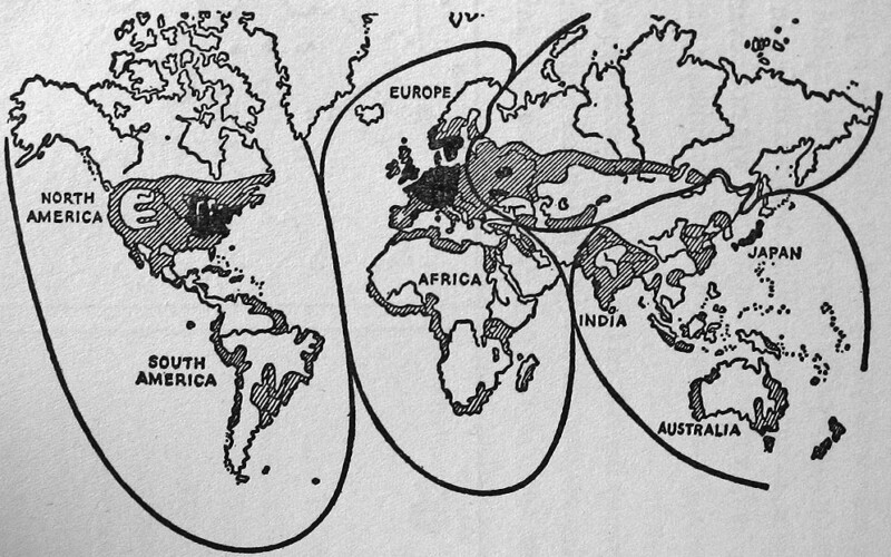
Heartlands, Chokepoints, and Conflict Zones: How Geopolitics Maps the World | Episode 212

PAST PROGRAM | Virtual Programs

Maps hold the power to organize and explain the world beyond what we can observe with our own eyes, making them extremely powerful political tools. Maps that express a geopolitical vision of how the world works (or should work) have been hugely influential in shaping military strategy, international relations, and public opinion. In this virtual program, our resident political geographer and cartographer Andrew Gustafson will give a crash course on the history of geopolitics as a discipline, using examples of these influential geopolitical imaginings from the past 150 years, from Halford Mackinder’s Heartland to Ronald Reagan’s Chokepoints; Karl Haushofer’s Pan-Regions to George W. Bush’s Axis of Evil.

>> Continue reading

December 7, 1917: The US Navy in World War I | Episode 170

PAST PROGRAM | Virtual Programs

December 7, 1941 is a date that is indelible in American history, but 24 years earlier, that date also marked an important moment: the arrival of Battle Division 9 to Scapa Flow, the first American battleships to join the British Grand Fleet, which included the Brooklyn Navy Yard-built USS New York and USS Florida. We will discuss the special role of the US Navy in the naval war, in which battleships actually played a very small part. Places like the Brooklyn Navy Yard were instead tasked with building submarine chasers and painting “dazzle” camouflage schemes to counter German U-boats, and American manufacturing was mobilized to produce more than 50,000 mines for the North Sea Mine Barrage to close off passage to the Atlantic from Germany.

>> Continue reading